| Rand McNally Easy to Read! Florida State Map Contributor(s): Rand McNally (Manufactured by) |
|
 |
ISBN: 0528881175 ISBN-13: 9780528881176 Publisher: Rand McNally OUR PRICE: $5.39 Product Type: Folded - Other Formats Published: March 2010 * Not available - Not in print at this time * |
| Additional Information |
| BISAC Categories: - Travel | United States - South - South Atlantic (dc, De, Fl, Ga, Md, Nc, Sc, Va, Wv) - Travel | Maps & Road Atlases (see Also Reference - Atlases, Gazetteers & Maps) |
| Dewey: 917.59 |
| Series: Rand McNally Easy to Read! |
| Physical Information: 0.23" H x 6.31" W x 9.26" (0.12 lbs) |
| Themes: - Geographic Orientation - Florida - Cultural Region - South Atlantic - Cultural Region - Southeast U.S. |
| Descriptions, Reviews, Etc. |
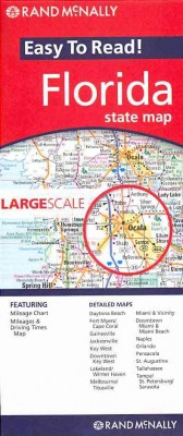
| Publisher Description: Rand McNally's Easy To Read State Folded Map is a must-have for anyone traveling in and around Florida, offering unbeatable accuracy and reliability at a great price. Our trusted cartography shows all Interstate, U.S., state, and county highways, along with clearly indicated parks, points of interest, airports, county boundaries, and streets. The easy-to-use legend and detailed index make for quick and easy location of destinations. You'll see why Rand McNally folded maps have been the trusted standard for years. Regularly updated, full-color maps Larger map with a bigger type size than the Rand McNally Folded Map Clearly labeled Interstate, U.S., state, and county highways Indications of parks, points of interest, airports, county boundaries, and more Mileage and driving times map Detailed index Convenient folded size Coverage Area Detailed maps of: Daytona Beach, Fort Myers/Cape Coral, Gainesville, Jacksonville, Key West, Downtown Key West, Lakeland/Winter Haven, Melbourne/Titusville, Miami & Vicinity, Downtown Miami & Miami Beach, Naples, Orlando, Pensacola, St. Augustine, Tallahassee Product Details: Florida State Dimensions (unfolded): 28" x 40". |